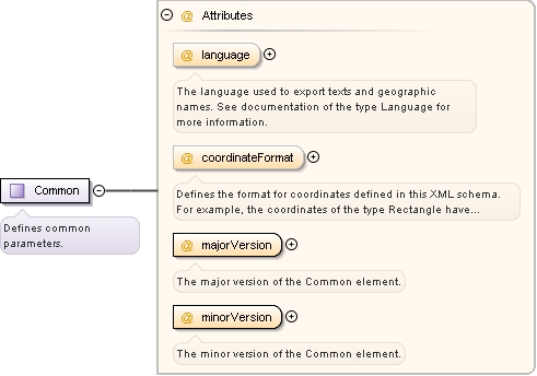
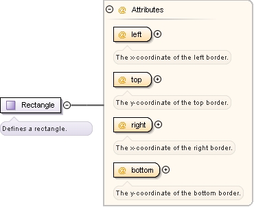
Defines the format for coordinates defined in this XML schema. For example, the coordinates of the type Rectangle have to be specified in this format. Note that all other coordinates not specified in an XML document based on this schema, for example start and destination coordinates of a route request, can be specified in a different format.
Defines a language through a language code according to the BCP 47 standard track defined by the Internet Engineering Task Force (IETF). For most cases the ISO 639-1 code suffices, region subtypes such as "en-US" are not supported. Examples: "en" for English or "de" for German. Note that it depends on the data whether or not texts are available in the given language.
PTV representation of coordinates according to the Mercator projection. Example: x=917420, y=6227729.
enumeration
PTV_GEODECIMAL
PTV representation of longitude/latitude coordinates as OG_GEODECIMAL coordinates multiplied by 100000. Example: x=825056, y=4876278.
enumeration
PTV_GEOMINSEC
PTV representation of longitude/latitude coordinates in degrees (d), minutes (m) and seconds (s) as a single integer number (d * 100000 + m * 1000 + s * 10) multiplied by sign. Example: x=815020, y=4845460 (x represents 8d 15m 2s).
Defines a country. This numeric code is PTV-specific and is usually the international dialing code of the country. Big countries may be split into several integration units; in this case both the code of the whole country and the integration unit codes can be used here. The special value "*" defines every country.
Defines a country. This numeric code is PTV-specific and is usually the international dialing code of the country. Big countries may be split into several integration units; in this case both the code of the whole country and the integration unit codes can be used here.
Defines the format for coordinates defined in this XML schema. For example, the coordinates of the type Rectangle have to be specified in this format. Note that all other coordinates not specified in an XML document based on this schema, for example start and destination coordinates of a route request, can be specified in a different format.
PTV representation of coordinates according to the Mercator projection. Example: x=917420, y=6227729.
enumeration
PTV_GEODECIMAL
PTV representation of longitude/latitude coordinates as OG_GEODECIMAL coordinates multiplied by 100000. Example: x=825056, y=4876278.
enumeration
PTV_GEOMINSEC
PTV representation of longitude/latitude coordinates in degrees (d), minutes (m) and seconds (s) as a single integer number (d * 100000 + m * 1000 + s * 10) multiplied by sign. Example: x=815020, y=4845460 (x represents 8d 15m 2s).