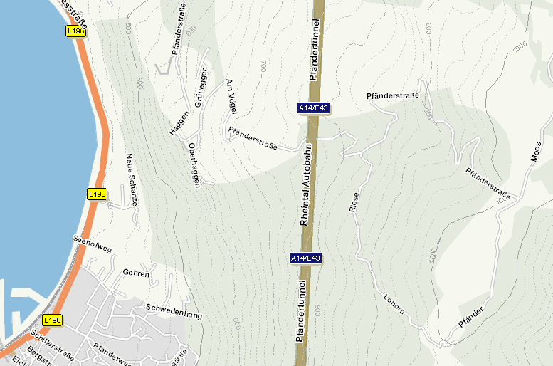
Using additional data content from PTV, a terrain layer can be selected in order to draw contour lines onto PTV maps. Please notice that this data has to be licensed.
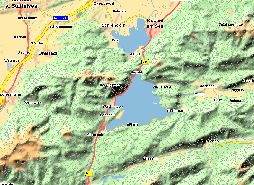
Creating a terrain layer and adding the additional data content from PTV (license fee is required), a relief can be plotted as shown in this figure.
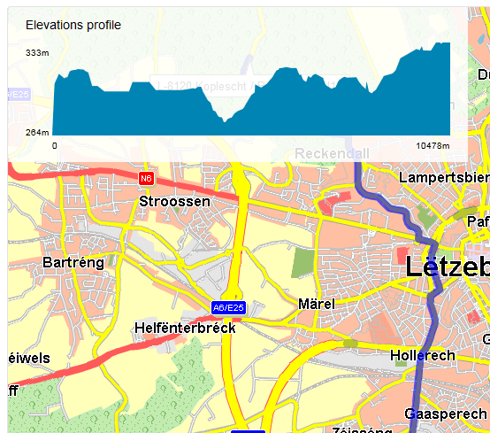
Getting the height information corresponding to a route from PTV xRoute Server, it is possible to show a height profile.
Copyright © 2025 PTV Logistics GmbH All rights reserved. | Imprint