For the reference point method, it is important to get a good and fast estimation for distances and driving periods for location pairs not included in a distance matrix. This is relevant for use cases where there is no time to calculate routings (e.g. in a call center discussing with an impatient customer the earliest possible delivery time). The estimation is based on a pre-calculated distance matrix. This matrix could be provided by PTV or created with the help of the PTV xDima Server.
A unique ID for the distance matrix must also be assigned for the reference point method. The approach is the same as in the routing-based method (see Routing based method). In case of a PTV-provided distance matrix, this step could be omitted.
Comparable to the routing-based method for calculating the distance table, locations have to be transferred. Since usually at this point in time the relevant locations in the future are unknown, the question is which locations should be chosen. In case of a PTV-provided distance matrix, this step could be omitted.
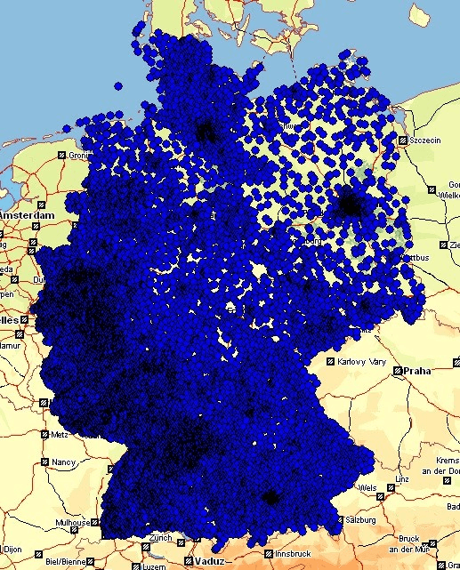
The locations in the distance matrix are used to estimate the distance and driving periods of location pairs not included in the distance matrix. They are the so-called reference points. How the estimation works in detail is described in chapter 2.2.4. As a rule of thumb, the closer a reference point is to a location not included in the distance matrix, the more precise the estimation. Therefore it is important to have a dense net of reference points in the area expecting the future locations. For example, if the whole area of Germany is in the focus, you can use the center of all postal codes as reference points. Then you have to calculate a distance matrix for several thousand locations.
In particular using the reference point method, routings between a great number of locations are calculated. So controlling the calculation progress also makes sense. The approach is the same as in the routing-based method (see Routing based method).
In order to estimate the single distances and driving periods, you have to transfer the location pairs not included in the distance matrix. For the reference point method, the mode REFPOINT has to be selected. The estimation is shown with the help of the following example:
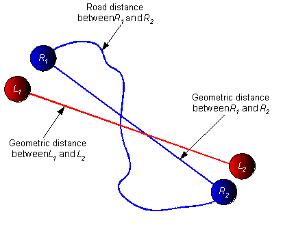
We are looking for the distance and driving period between the locations L1 and L2. They are not included in the pre-calculated distance matrix. In a first step, for each location the nearby reference point is searched (in this case location R1 and R2). As the geometric distance is calculated on the fly, the geometric distance between L1 and L2 and between R1 and R2 is known. Moreover, the routing-based distance and driving period between R1 and R2 is known from the distance matrix. It is believed that the topology between L1 and L2 is comparable to the topology between R1 and R2, that means comparable or even the same roads would be used in the routing. From the ratio of road distance to geometric distance between R1 and R2, the distance between L1 and L2 could be estimated.
The quality of the reference points in the distance matrix has a strong impact on the quality of the estimation. You have to think twice about the selection of the reference points. Of course, if a transferred location pair is included in the distance matrix as a reference point, you get the same quality as in the routing-based method and not an estimation.
Copyright © 2025 PTV Logistics GmbH All rights reserved. | Imprint